Trip overview
Overview: Kang La Pass 15-day trek
Introduction: Discovering Kang La Pass Trek
The Kang La Pass Trek is an extraordinary expedition in the heart of the Himalayas. It offers an immersive journey through some of Nepal’s most spectacular and unspoiled landscapes. This remote and less-explored route challenges adventurous souls with rugged mountain terrain, vibrant cultural encounters, and breathtaking panoramic views. The trek lasts about 17 days and takes you across the iconic Kang La Pass, which stands at around 5,300 meters (17,390 feet). This pass connects the beautiful Manang region with the Annapurna Circuit.
For avid trekkers and mountaineers who want to escape crowded trails and explore authentic Himalayan wilderness, the Kang La Pass trek is the perfect gateway. It is demanding but rewarding, combining high-altitude trekking with traditional villages and pristine nature few travelers experience.
Location and Geographical Setting
Kang La Pass is in the north-central part of Nepal. It bridges the Annapurna region and the upper Manang valley. This high mountain pass lies between the towering peaks of the Annapurna range and the snowy ridges of the Manang Himalayas. It creates a natural corridor that local traders and nomads have used for centuries.
The trek usually starts from the bustling town of Besisahar, or sometimes from Nayapul. Trekkers gradually ascend through lush forests, alpine meadows, and rugged cliffs before reaching the high pass. After crossing Kang La Pass, they descend into the serene valleys of Manang, known for their stark beauty and rich culture.
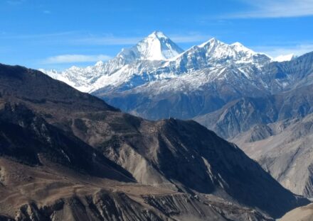
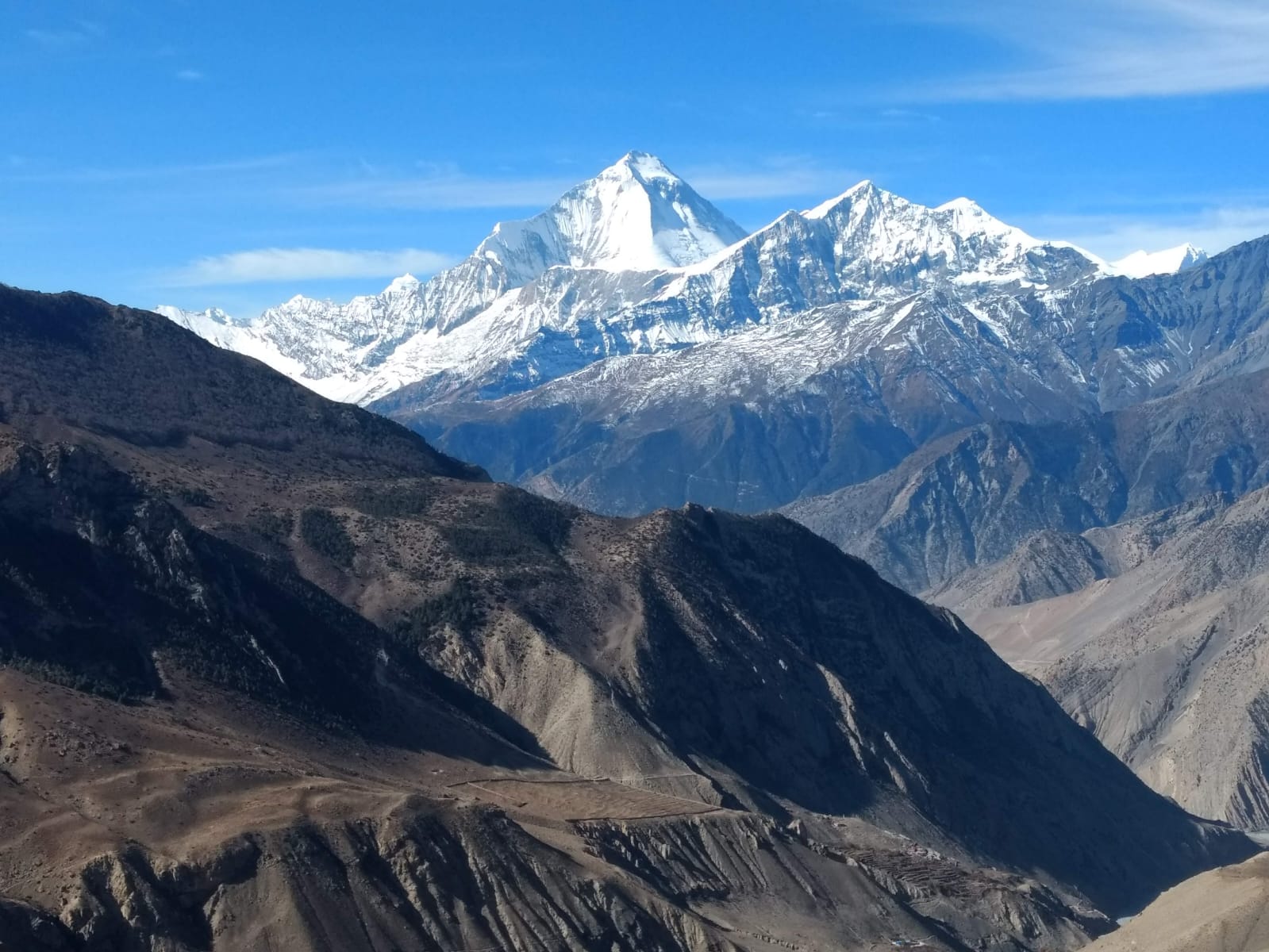
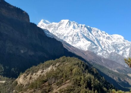
The trail offers magnificent vistas of prominent mountains such as Annapurna II, Gangapurna, Tilicho Peak, and the mighty Thorong La. The geographic diversity along the route ranges from subtropical forests at lower elevations to alpine shrubs and finally the stark rocky terrain of the high Himalayas.
The Greatness and Challenges of Kang La Pass Trek
Undoubtedly, the Kang La Pass trek is a strenuous yet immensely gratifying adventure. It stands out for its high altitude, challenging ascents, and occasionally unpredictable weather conditions. Trekkers should be prepared for steep climbs, long hiking days, and significant altitude gain, all of which test one’s endurance and physical resilience.
The difficulty of the trek lies not only in the physical exertion required but also in navigating some tricky trail sections, especially near the pass where snow or ice may persist for much of the year. The high elevation also means that acute mountain sickness (AMS) can pose a risk, demanding careful acclimatization and mindful pacing.
Nevertheless, the natural beauty and sense of accomplishment make these challenges worthwhile. The passage through remote and scarcely populated areas adds an element of solitude and connection to nature, far removed from the typical commercialized trekking routes.
Fitness and Health Requirements
Given the demanding nature of the Kang La Pass trek, a good level of physical fitness is essential. Trekkers should ideally have prior experience with moderate to strenuous hiking and be capable of walking for several hours daily at high altitudes.
Cardiovascular endurance, muscle strength, and stamina are crucial to handle the steep ascents and long trekking days. Preparation can include regular aerobic exercises such as running, cycling, swimming, and uphill hiking. Strength training focused on legs and core muscles is highly beneficial.
Moreover, maintaining good health before embarking on this trek is imperative. Conditions such as heart or respiratory problems require consultation with a healthcare professional. Proper acclimatization days are incorporated into the itinerary to minimize the risks of altitude sickness.
Additionally, mental preparedness and a positive attitude greatly contribute to coping with the physical and emotional demands of high-altitude trekking.
Highlights of the Kang La Pass Trek
The Kang La Pass trek is abundant in remarkable highlights that captivate trekkers from start to finish. Among the most notable experiences are:
Spectacular Mountain Views: The trail offers unimpeded views of Annapurna II, Annapurna IV, Gangapurna, Tilicho Peak, and the majestic Manaslu range in the distance. Sunrise and sunset over these snowy summits create mesmerizing scenes.
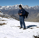
Crossing Kang La Pass: The trek’s pinnacle is crossing the Kang La Pass itself, a thrilling moment that rewards trekkers with awe-inspiring 360-degree panoramas and a profound sense of achievement.
Traditional Himalayan Villages: The trek passes through several rustic settlements such as Manang, Ngawal, and Pisang, where time seems to have stood still. Visitors experience warm hospitality and observe age-old Tibetan Buddhist customs.
Rich Flora and Fauna: The diverse ecosystems range from dense rhododendron forests to alpine meadows dotted with wildflowers. Wildlife such as Himalayan thar, snow leopards (rare sightings), and various bird species enrich the trek.
Cultural Encounters: Along the way, trekkers visit Buddhist monasteries, mani walls, and chortens, immersing themselves in the spiritual heritage of the region.
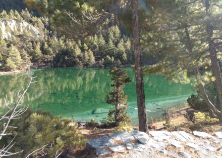
Lakes and Natural Wonders: Tilicho Lake, one of the highest alpine lakes in the world, is accessible via a side trek and is a spectacular natural attraction close to the Kang La Pass route.
What Is Included in the Cost?
The overall cost of the Kang La Pass Trek varies depending on the level of service, group size, and season. At The Himalayan Realms Treks, we offer competitively priced packages that provide excellent value, ensuring comfort, safety, and memorable experiences.
Typically, the cost covers:
Permits: All necessary trekking permits such as Annapurna Conservation Area Permit (ACAP) and TIMS (Trekkers’ Information Management System) card. Professional Guide: Experienced, licensed trekking guides with excellent knowledge of the region, culture, and safety procedures. Porters: To carry heavy loads, allowing trekkers to walk comfortably with a daypack. Accommodation: Teahouse or lodge stays along the trekking route with basic but comfortable facilities. Meals: Breakfast, lunch, and dinner during trekking days, providing nourishing and energy-rich foods.Transportation: Airport transfers, and local transportation to and from the trailheads. Support and Safety: Emergency rescue assistance, first aid kits, and 24/7 company support during the trek.Trekking Equipment: Optional rental of sleeping bags, down jackets, and trekking poles. Additional costs may include personal expenses, travel insurance, and tips.
People Settlement and Culture Along the Trail
The Kang La Pass trek weaves through small, remote villages inhabited predominantly by ethnic groups such as the Gurung, Manangi, and Tibetan Buddhist communities. These settlements are characterized by their traditional stone houses with flat roofs and prayer flags fluttering in the mountain breeze.
The residents lead a simple lifestyle primarily based on subsistence agriculture, animal husbandry, and increasingly, tourism-related activities. Yak herding is common in the higher pastures, while barley, potatoes, and buckwheat are staple crops grown in terraced fields.
Visitors have the unique opportunity to engage with hospitable locals, who follow centuries-old customs and religious practices. The Buddhist culture is deeply rooted in the region, with numerous monasteries, prayer wheels, and stupas marking the landscape. Festivals and rituals provide glimpses into their spiritual life and communal bonds.
Lifestyle, Vegetation, and Atmosphere
The harsh Himalayan environment and Buddhist philosophy profoundly influence the lifestyle in the Kang La Pass region. People live a slow-paced life, harmonize with nature, and show resilience against the challenging climate.
Vegetation changes dramatically with altitude.
Lower elevations have dense forests of rhododendron, pine, and oak. Higher zones change into alpine meadows filled with wildflowers like primulas and gentians. Above the treeline, hardy shrubs and mosses survive in the thin air and cold temperatures.
The atmosphere along the trek is one of serene tranquility. It is occasionally punctuated by the bells of prayer or fluttering colorful prayer flags. Crisp mountain air, vast open skies, and snow-capped peaks create a spiritual ambiance that inspires awe and reflection.
Why Choose The Himalayan Realms Treks for Kang La Pass Trek?
Selecting the right trekking company can significantly enhance your Kang La Pass experience. The Himalayan Realms Treks and Expedition Nepal Pvt. Ltd. is your ideal partner for several compelling reasons:
Expertise and Experience: With decades of combined experience in Nepal’s trekking industry, our team boasts deep knowledge of the Kang La region, ensuring a safe and well-organized journey.
Professional Guides: Our certified guides are not only experts in mountain navigation but also passionate cultural ambassadors, enhancing your understanding of local traditions and environments.
Customized Service: We tailor itineraries to fit your fitness level, interests, and time frame, offering flexible options that cater to individual preferences.
Commitment to Sustainability: We prioritize eco-friendly practices, support local communities, and encourage responsible tourism that respects the fragile Himalayan ecosystem.
Comprehensive Support: From arrival to departure, our 24/7 support ensures your trek runs smoothly, including emergency rescue preparedness and medical assistance.Competitive Pricing: We offer transparent pricing with no hidden costs, delivering excellent value for the high-quality service provided.Authentic Cultural Interaction: We foster meaningful connections between trekkers and local people, creating enriching experiences beyond just sightseeing.
Conclusion:
The Kang La Pass Trek is more than just a hike. It is a transformative adventure that challenges your body, enlightens your mind, and touches your soul. On this demanding route, trekkers immerse themselves in the grandeur of the Himalayas. They meet warm and genuine mountain cultures and witness the pristine beauty of Nepal’s remote wilderness.
The Himalayan Realms Treks and Expedition Nepal Pvt. Ltd. plans and secures every step of your Kang La Pass journey. Whether you are an experienced trekker seeking new horizons or a nature lover wanting solitude and scenic beauty, this 17-day trek promises unforgettable memories.
Embark on the Kang La Pass Trek and discover the magic of Nepal’s high mountains. Here, the sky touches the earth, and every breath is a gift.
Itinerary
Kathmandu (1,350 m / 4,429 ft) → Drive to Besisahar (760 m / 2,493 ft):- The first leg of the Kang La Pass Trek begins with an early morning departure from Kathmandu, usually around 7:00 to 8:00 a.m., after breakfast. We travel by a comfortable tourist bus, leaving behind the bustle of the capital and heading west along the Prithvi Highway. The road winds alongside the Trishuli River, where emerald waters cut through deep valleys. As we drive, lush hills, terraced farmlands, and scattered villages give us a taste of rural Nepalese life.
Around midday, we stop for lunch at a riverside restaurant, enjoying a break and sampling fresh Nepali dal bhat or light snacks. The air becomes fresher as we ascend gently, and the scenery transforms with every hour. Snow-capped peaks start peeking in the distance, and you’ll notice the change from subtropical greenery to cooler hill vegetation.
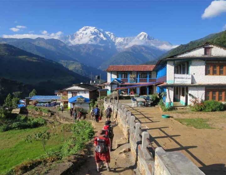
The entire journey takes around 6 to 7 hours, depending on traffic and road conditions. By afternoon, we arrive in Besisahar, the district headquarters of Lamjung and the gateway to the Annapurna region. This vibrant hill town offers panoramic views of the surrounding hills and glimpses of the mighty Himalayas.
Besisahar is more than just a stopover; it is a lively center where trekkers, locals, and traders mingle. The streets are lined with shops, teahouses, and friendly faces. As the sun sets, the warm golden light over the surrounding ridges sets the tone for the adventure ahead—reminding you that the Kang La Pass journey has truly begun.
Besishahar to Koto—Into the Heart of the Himalayas (2,600 m / 8,530 ft):After breakfast in Besisahar, the journey continues with an exciting off-road jeep ride toward Koto. Unlike the smooth highway from Kathmandu, today’s route is a thrilling mountain road adventure. The path follows the Marsyangdi River, winding through narrow valleys, cascading waterfalls, and lush green forests. Every turn reveals new scenery—steep cliffs, roaring river rapids, and small suspension bridges connecting picturesque villages.
The ride takes about 6 to 7 hours, depending on road conditions, which can be affected by weather. Along the way, we pass charming settlements like Syange, Tal, and Dharapani, each offering glimpses of local life and traditional stone houses. The air grows cooler and crisper as we gain altitude, and the vegetation gradually changes from subtropical greenery to coniferous forests. Snow-dusted peaks begin to appear more prominently, signaling our arrival into true Himalayan country.
Lunch is usually enjoyed in one of the roadside teahouses, where hearty meals like fried rice, noodles, or dal bhat warm and energize us for the journey ahead. The route also offers countless opportunities to pause for photos, capturing the dramatic landscapes and the raw beauty of the Annapurna region.
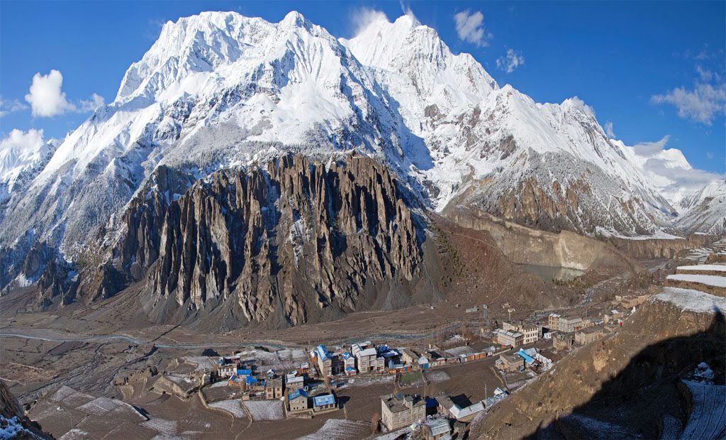
By late afternoon, we reach Koto, a peaceful village surrounded by pine forests and towering mountains. Situated at 2,600 meters (8,530 ft), Koto serves as an entry point to the remote Nar Phu Valley and the Kang La Pass adventure. The evening is spent relaxing, acclimatizing, and soaking in the serene mountain atmosphere before the trekking days truly begin.
Koto to Meta—Into the Nar Phu Valley (3,560 m / 11,680 ft): - The trekking adventure truly begins as we set out from Koto after an early breakfast. Today’s route leads us deep into the Nar Phu Valley, a restricted and less-trodden part of the Annapurna region. Before leaving Koto, we register our permits at the check post, then follow the trail along the Soti Khola River. The sound of rushing water accompanies us as we walk through dense pine forests, where moss-covered rocks and rhododendron trees create a mystical atmosphere.
The path alternates between gentle ascents and steeper sections, often hugging the cliffside with dramatic drops to the river below. Several wooden and suspension bridges add an adventurous touch to the day. We pass through a series of small caves, prayer walls, and chortens, each hinting at the deep Buddhist heritage of the region.
After about 6 to 7 hours of steady trekking, we begin to notice a stark change in the landscape. The thick forests give way to more open, barren slopes with scrub vegetation, and the air feels cooler and drier. Snow-capped peaks such as Lamjung Himal and Annapurna II appear closer, framing the horizon with grandeur.
By mid to late afternoon, we arrive in Meta, a small settlement perched on a broad plateau at 3,560 meters (11,680 ft). The views here are spectacular—vast, windswept valleys with towering mountains in every direction. Evening in Meta is quiet and peaceful, perfect for watching the sunset paint the peaks in shades of gold and crimson before settling in for a well-earned rest.
Meta to Phu Village – Gateway to the Ancient Fortress Settlement (4,080 m / 13,386 ft)
Leaving Meta after breakfast, we continue our journey deeper into the wild and remote Nar Phu Valley. The trail today is a blend of rugged mountain paths, narrow ridges, and sweeping open valleys. Almost immediately, the scenery feels more arid and high-altitude, with jagged cliffs, scattered juniper bushes, and dramatic rock formations. The forested terrain is now far behind, replaced by windswept landscapes reminiscent of Tibet.
We follow the route through several seasonal herding settlements, such as Jhunam and Chyakhu, where stone shelters are used by locals during summer grazing months. Prayer flags flutter in the breeze, and mani walls line parts of the trail, giving the walk a distinctly spiritual feel. Along the way, we pass the ancient ruins of an old fortress—remnants of a time when this valley was a key trade route between Nepal and Tibet.
The hike takes about 6 to 7 hours at a steady pace, with moderate ascents and occasional steep climbs. High peaks like Himlung Himal and the surrounding ranges rise dramatically around us, and the crisp mountain air adds a sense of freshness to every step.
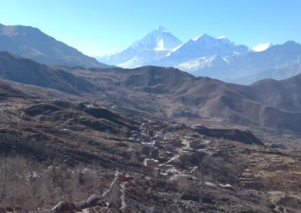
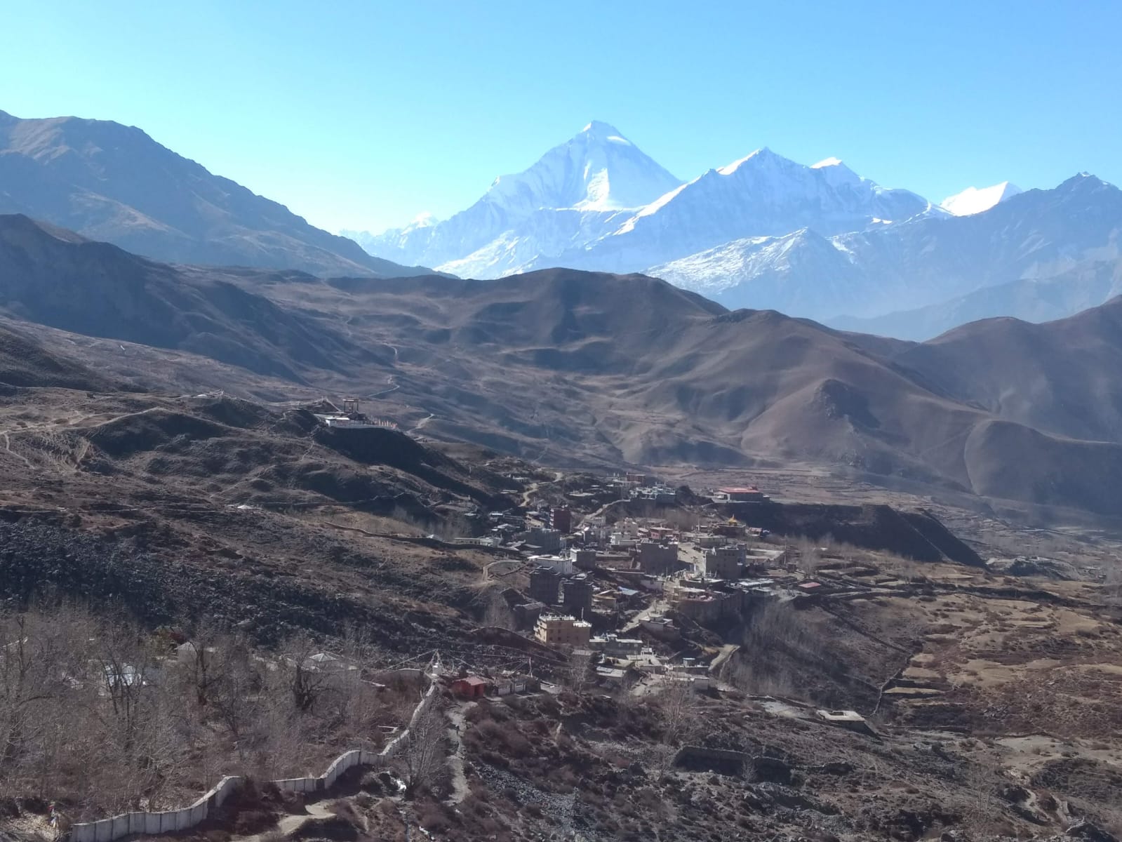
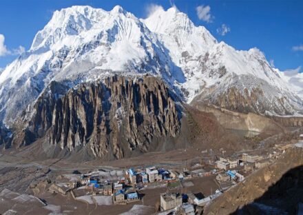
Approaching Phu Village is a breathtaking experience. Built on a high ridge overlooking the valley, the village appears like a stone fortress clinging to the hillside. Its cluster of traditional houses, centuries-old monastery, and dramatic mountain backdrop make it one of the most photogenic settlements in the Himalayas. At 4,080 meters (13,386 ft), Phu offers a unique blend of ancient culture, isolation, and stunning high-altitude beauty.
Acclimatization & Exploration in Phu—Immersing in High-Altitude Culture (4,080 m / 13,386 ft)
Today is dedicated to rest and acclimatization in the beautiful and remote Phu Village. At this elevation, it’s essential to let the body adjust to the thinner air, ensuring a safer and more enjoyable trek ahead. Rather than remaining idle, we use the day to explore this culturally rich and historically significant settlement.
Phu is a centuries-old fortress-like village, perched high on a ridge with breathtaking views of the surrounding mountains, including Himlung Himal. Its stone houses, narrow alleys, and ancient walls tell stories of a bygone era when the valley served as a key trade link between Nepal and Tibet. Wandering through the village, we encounter traditional lifestyles unchanged for generations—locals spinning wool, drying barley, and herding yaks.
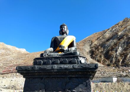
A highlight of the day is visiting Tashi Lakhang Monastery, one of the oldest Buddhist monasteries in the region, believed to have been blessed by the great Tibetan saint, Karmapa Rinpoche. Inside, colorful murals, prayer wheels, and the gentle sound of chanting create a deeply spiritual atmosphere.
For those seeking light activity, short hikes to nearby viewpoints offer panoramic vistas of the valley and surrounding peaks. The dry, high-altitude terrain, dotted with chortens and prayer flags, provides excellent photography opportunities.
Evening in Phu is serene, with the village bathed in golden light before nightfall. This day not only strengthens our bodies for the journey ahead but also enriches our hearts with the culture, history, and hospitality of one of the Himalaya’s most secluded communities.
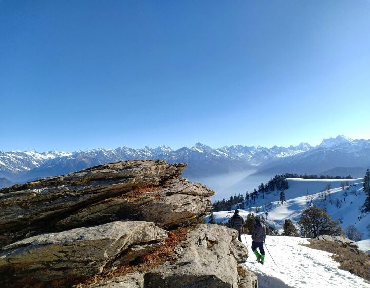
Phu to Ngawal via Kang La Pass—The High Point of the Journey (5,320 m / 17,454 ft): Today is one of the most challenging and rewarding days of the Kang La Pass Trek. We begin before dawn, leaving Phu under the faint glow of headlamps. The air is crisp, and the stars sparkle brilliantly above the rugged valley. The trail climbs steadily from the village, crossing moraines and alpine meadows before reaching the base of Kang La Pass.
The ascent is long and demanding, with steep switchbacks over loose scree and snow patches. At this altitude, every step requires patience and steady breathing, but the views grow more dramatic with each gain in height. Reaching the top of Kang La Pass at 5,320 meters (17,454 ft) is a truly triumphant moment. The panorama from the pass is breathtaking—snow-covered peaks like Annapurna II, Gangapurna, and Tilicho Peak stretch endlessly across the horizon, while deep valleys fall away on either side.
After enjoying the views and capturing photographs, we begin the long descent toward Ngawal. The path is initially steep, winding down through rocky slopes before easing into open alpine terrain. Gradually, patches of grass and juniper reappear, signaling our return to lower elevations.
Ngawal, at 3,675 meters (12,057 ft), is a charming village on the upper Annapurna Circuit, known for its traditional stone houses, chortens, and sweeping views of the Annapurna range. The sense of achievement is immense—having crossed a high Himalayan pass, we can now relax and celebrate with a hearty meal while watching the sunset over the mountains.
Ngawal to Manang – A Leisurely Descent into the Annapurna Valley (3,540 m / 11,614 ft):- After breakfast in Ngawal, we begin a relaxed trekking day compared to the previous high-pass challenge. The trail descends gently from the village, offering sweeping views of the Annapurna range, including Annapurna II, III, and Gangapurna, glowing in the morning light. The air is warmer, and the path passes through terraced fields, juniper bushes, and small clusters of stone houses, giving a welcoming, settled feel to the landscape.
Along the way, we pass traditional chortens and mani walls, reminders of the region’s deep Buddhist culture. The trail offers occasional glimpses of the Marsyangdi River far below and the turquoise Gangapurna Lake in the distance. The change in vegetation is noticeable as we move into a lower, more fertile valley, with willow trees and cultivated barley fields adding vibrant color to the surroundings.
The walk from Ngawal to Manang takes around 3 to 4 hours at a steady pace, making it a pleasant recovery day after the strenuous Kang La Pass crossing. This section is also part of the main Annapurna Circuit route, so you may encounter more trekkers along the way.
By midday, we arrive in Manang, a bustling Himalayan hub at 3,540 meters (11,614 ft). Known for its comfortable teahouses, bakeries, and mountain gear shops, Manang is both a cultural center and a vital acclimatization stop for high-altitude trekkers. The afternoon can be spent exploring the village, visiting monasteries, or simply relaxing with a view of the majestic Gangapurna Glacier before preparing for the next stage of the journey.
Acclimatization & Rest in Manang – Breathing Easy in the High Himalayas (3,540 m / 11,614 ft): -Today is set aside for rest and acclimatization in Manang, an essential pause before venturing into higher altitudes. At 3,540 meters (11,614 ft), the air is already thinner, so giving the body time to adapt helps prevent altitude sickness and ensures a smoother trek ahead. But a rest day here is far from idle—Manang offers plenty to explore.
The village is beautifully set in a wide valley, surrounded by the soaring peaks of Annapurna II, III, Gangapurna, and Tilicho. In the morning, many trekkers enjoy a short acclimatization hike to the Gangapurna Lake viewpoint, which offers spectacular views of the turquoise glacial waters and the dramatic icefall above. Another rewarding option is the climb to Bhojo Gumba or the higher Praken Gompa, where a resident lama offers blessings for safe passage through the mountains.
Wandering through Manang itself is equally fascinating. Narrow stone-paved streets wind between traditional houses, while local shops sell everything from yak wool scarves to trekking gear. Teahouses and bakeries tempt visitors with fresh pastries and steaming cups of coffee—an unexpected luxury in such a remote setting.
The afternoon can be spent attending a short lecture at the Himalayan Rescue Association’s clinic, where trekkers learn valuable tips about high-altitude health. As the sun sets, the peaks glow in shades of gold and crimson, casting a magical light over the valley.
A day in Manang not only strengthens the body but also rejuvenates the spirit, blending rest, light activity, and immersion in Himalayan culture.
Manang to Tsuri Lather / Yak Kharka – Gaining Height in the Alpine Zone (4,020 m / 13,189 ft):- Leaving the comforts of Manang behind, we begin our gradual ascent toward the higher reaches of the Annapurna region. The trail climbs gently out of the valley, following the Marsyangdi River before crossing over a wooden bridge. Almost immediately, the scenery changes—lush fields give way to sparser vegetation, with scattered juniper bushes and hardy alpine grasses replacing the fertile terraces of lower altitudes.
The air grows cooler and crisper, and the mountains feel closer than ever. We pass through the small settlement of Gunsang, where traditional stone houses cling to the hillside, offering a perfect place for a short tea break. Herds of yaks graze on the slopes, their bells echoing through the valley, while snow-capped peaks like Annapurna III, Gangapurna, and Chulu West dominate the skyline.
This section of the trek is steady rather than steep, allowing our bodies to adjust naturally to the increasing altitude. The walk takes about 3 to 4 hours at a relaxed pace, minimizing the risk of overexertion. Along the way, we spot chortens, prayer flags, and mani walls—spiritual symbols that add a sense of tranquility to the journey.
By early afternoon, we arrive at Tsuri Lather or Yak Kharka (both located around 4,020 m / 13,189 ft), small but welcoming clusters of lodges nestled in the alpine wilderness. The rest of the day is for relaxation, enjoying warm drinks, and watching the evening sun cast golden light across the rugged Himalayan peaks—an unforgettable prelude to the days ahead.
Tsuri Lather / Yak Kharka to Thorong High Camp – Preparing for the Summit Push (4,880 m / 16,010 ft):-From Tsuri Lather or Yak Kharka, the trail climbs steadily as we approach Thorong High Camp, the crucial staging point before the famous Thorong La Pass. Leaving behind the sparse alpine meadows, the path winds upward through rocky terrain and occasional patches of hardy shrubs and wildflowers.
The trek typically takes around 4 to 5 hours, allowing for a gradual ascent that helps our bodies continue acclimatizing. The altitude gain is significant—from approximately 4,020 meters (13,189 feet) at Yak Kharka to 4,880 meters (16,010 feet) at Thorong High Camp. The air becomes noticeably thinner, and the landscape more rugged and dramatic, with towering peaks surrounding the narrow valley.
Along the way, trekkers often pause to rest at small teahouses scattered on the trail. These spots provide warm drinks and snacks, perfect for regaining energy before the final push to high camp. The views are spectacular, with Annapurna South and Gangapurna dominating the skyline.
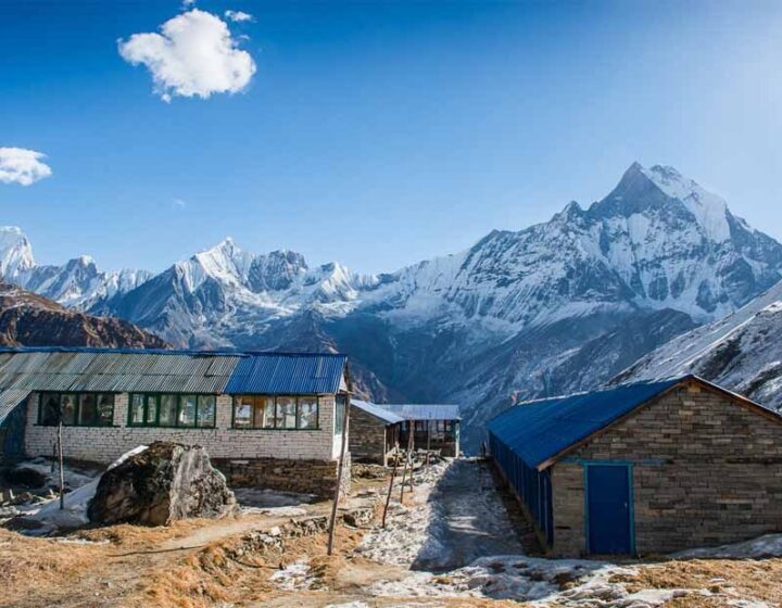
Thorong High Camp itself is a small cluster of lodges perched on a rocky slope. From here, trekkers prepare for the early morning crossing of Thorong La Pass, the highest point on the Annapurna Circuit at 5,416 meters (17,769 feet). The camp offers breathtaking panoramic views, and the quiet, crisp mountain air sets a contemplative mood before the challenging summit day.
Thorong High Camp to Muktinath – Crossing the Thorong La Pass (5,416 m / 17,769 ft) and Descending to the Sacred Valley (3,800 m / 12,467 ft)
The day begins very early—often before sunrise—to make the most of firm trail conditions for the challenging ascent to Thorong La Pass, the highest point on the Annapurna Circuit at 5,416 meters (17,769 feet). Wrapped in warm layers and equipped with headlamps, trekkers steadily climb under the fading stars and the first pale light of dawn.
The trail is steep and demanding, but the altitude gain rewards trekkers with stunning 360-degree views of Himalayan giants like Dhaulagiri, Nilgiri, and Annapurna ranges. The crisp mountain air and vast silence create a profound sense of achievement as you reach the pass, where prayer flags flutter against the sky.
After soaking in the breathtaking panorama and snapping photos, the journey turns into a long but mostly downhill trek toward Muktinath. The descent passes through high desert landscapes, marked by barren hills, scattered shrubs, and traditional stone walls. The air grows warmer as we descend to 3,800 meters (12,467 feet), and the environment becomes less harsh.
Muktinath is a sacred pilgrimage site for both Hindus and Buddhists, famous for its ancient temples and natural springs. Arriving here feels like reaching a spiritual sanctuary, a perfect place to rest and reflect after the demanding pass crossing. Lodges in Muktinath offer comfortable accommodations and hot meals, welcoming trekkers with warm hospitality and a peaceful atmosphere.
Muktinath to Jomsom – Scenic Descent Through the Mustang Valley (3,800 m to 2,720 m / 12,467 ft to 8,924 ft):- The day usually starts around 8:00 a.m. after a hearty breakfast in Muktinath. From here, the trail leads downhill toward Jomsom, making this one of the easier and more relaxing trekking days on the Kang La Pass itinerary. The walk typically takes 4 to 5 hours, covering approximately 19 kilometers, depending on your pace and weather conditions.
The trail follows the Kali Gandaki River valley, passing through arid, rocky landscapes characteristic of the Mustang region. You’ll see fascinating desert-like hills, layered with rich ochre and red hues, contrasting beautifully against the blue sky. Small Mustang villages dot the valley, each with traditional flat-roofed houses and colorful prayer flags fluttering in the wind.
Along the way, you’ll find several tea houses and local bhattis (small eateries) perfect for stopping for refreshments or lunch. Lunch is often enjoyed in a cozy lodge with views of the surrounding hills and snow-capped peaks like Nilgiri and Annapurna ranges. Typical meals include dal bhat, noodles, or fried rice.
The trail is mostly downhill, with gentle sections, making it relatively easy for trekkers of moderate fitness. The terrain is rocky and uneven at times, so sturdy footwear and careful footing are recommended. This segment offers plenty of photo opportunities and a chance to relax while soaking in the stark beauty and unique culture of Upper Mustang.
By mid-afternoon, you arrive in Jomsom, a lively town with shops, cafes, and an airport—your gateway back to Pokhara or Kathmandu.
Jomsom to Pokhara—A Scenic Flight Back to the City
After the adventurous trekking days in the Kang La Pass and Mustang region, the journey continues with a short but unforgettable early morning flight from Jomsom to Pokhara. Most flights depart between 6:00 and 7:30 a.m., taking advantage of the calm morning air for a smooth ride.
The airport in Jomsom is small and rustic, nestled at 2,720 meters (8,924 feet) amid towering cliffs and rugged landscapes. Boarding a small aircraft, you’ll be treated to spectacular aerial views of the Kali Gandaki Gorge—the deepest gorge in the world—and the surrounding Annapurna and Dhaulagiri mountain ranges. The dramatic contrast between the arid Mustang hills and the lush greenery of the Pokhara valley becomes visible as the plane descends.
The flight duration is about 20 to 30 minutes, but the breathtaking scenery makes it feel like a special part of the trek itself. On clear days, the panoramic views include snow-capped peaks, terraced fields, and serene lakes shimmering in the morning light.
Pokhara’s airport is more modern and busier, marking the transition from remote mountain adventure back to city life. Upon arrival, trekkers can enjoy the comforts of the lakeside city—cafés, restaurants, and cozy guesthouses. It’s a perfect place to relax, reflect on the trek’s highlights, and prepare for onward travel.
The early morning flight saves time and energy, making it the preferred way to return from Jomsom after days of trekking.
Pokhara to Kathmandu—A Quick and Scenic Flight Across Nepal:After enjoying the tranquil beauty of Pokhara, the next step is a comfortable and time-saving flight back to Kathmandu. Flights between Pokhara and Kathmandu operate frequently throughout the day, with many early morning options to suit travelers’ schedules. The flight usually takes about 25 to 30 minutes.
Departing from Pokhara Airport, nestled beside Phewa Lake and surrounded by the Annapurna foothills, the plane ascends over lush green hills, shimmering lakes, and terraced farmland. The aerial views offer a stunning contrast between the serene Pokhara valley and the rugged, high Himalayan terrain visible to the north.
As the plane approaches Kathmandu, the bustling capital city unfolds beneath, with its dense urban sprawl, historic temples, and winding streets. The approach offers glimpses of the Kathmandu Valley’s rich cultural heritage, including pagodas and stupas dotting the cityscape.
Flying is the fastest and most convenient way to travel between Pokhara and Kathmandu, avoiding the long and sometimes bumpy 6- to 8-hour drive over the mountainous highway. This flight allows trekkers and travelers to maximize their time exploring Nepal’s diverse landscapes and cultures.
Upon arrival at Tribhuvan International Airport in Kathmandu, you can easily access hotels, markets, and sightseeing spots, making it an ideal gateway for continuing your Nepal adventure or preparing for departure.
Final Departure from Kathmandu—Heading to Tribhuvan Domestic Airport
As your unforgettable Nepal journey comes to a close, the final step is a smooth transfer from your Kathmandu hotel to Tribhuvan International Airport’s domestic terminal. Depending on your flight schedule, this transfer usually starts early to ensure timely arrival for your domestic or connecting flight.
Tribhuvan International Airport, Nepal’s main gateway, is located about 6 kilometers east of central Kathmandu. The drive from the city center typically takes 20 to 30 minutes, depending on traffic conditions. Early morning departures are recommended to avoid the city’s busy peak hours and ensure a stress-free transfer.
The domestic terminal at Tribhuvan Airport handles all internal flights, including popular routes to Pokhara, Lukla, Jomsom, and other regional airports. Upon arrival, you will check in your luggage, go through security, and prepare for your flight. Airport staff are helpful and accustomed to assisting trekkers and tourists, making the process efficient.
Before departure, take a moment to reflect on your Himalayan adventure—from bustling Kathmandu streets and serene mountain villages to breathtaking passes and sacred sites. The domestic terminal offers basic amenities such as small cafes and waiting areas to make your last moments comfortable.
Whether you’re catching a flight to another Nepalese destination or connecting to your international journey, the transfer from Kathmandu city to Tribhuvan’s domestic terminal marks the final chapter of your Nepal trekking experience, filled with memories that will last a lifetime.
Included
- All airport, hotel airport transfers.
- 2-night hotel in Kathmandu
- 1-night hotel in Pokhara
- Conservation premit fee
- Jeep from Besisahar to Chame
- Accommodation in the tea house
- Food, Tea/coffee during trek.
- Guide: – including salary, insurance, equipment, flight, food and lodging.
- Porter: – including salary, insurance, equipment, food and lodging
- For guest: -Down jacket, Good sleeping bag (down jacket and sleeping bag are to be returned after trip completion).
- Flight fear from Jomsom to Pokhara for guest and guide.
- Transfer from Pokhara hotel to Airport
- Transfer from Kathmandu Airport to hotel in Kathmandu
- All government and local taxes.
- All government and local taxes.
Not Included
- Food in Kathmandu ( Lunch & Dinner). Kathmanmdu and Pokhara.
- Bakery food during the trek.
- Nepal Visa fee.
- International airfare.
- Extra night accommodation in Kathmandu.
- Travel and rescue insurance if guest get mountain sickness and need to rescue helicopter.
- Personal expenses example (phone calls, laundry service , bar bills, battery recharge, WIFI charge, extra porters, bottle water or boiled water, shower etc.)
- Tips for guide and porters. If you are happy with theirs services.
- Sightseeing sport fees. tours guide cost and vechicle cost
Useful Info
The Kang La Pass Trek is a remarkable Himalayan journey that takes you into one of Nepal’s most remote and less-trodden corners. Standing at around 5,320 meters (17,454 feet), the pass connects the isolated Nar and Phu Valleys in the Annapurna region with Manang. This trek combines high-altitude adventure with a fascinating mix of Tibetan-influenced culture, dramatic landscapes, and raw wilderness.
Best Season to Trek
The ideal time to cross Kang La Pass is during spring (March–May) and autumn (September–November). During these months, the weather is stable, skies are clear, and visibility of surrounding peaks like Annapurna II, Himlung Himal, and Tilicho Peak is at its best. Winter brings heavy snow, making the pass dangerous, while the monsoon season causes landslides and slippery trails.
Trek Duration & Difficulty
Typically, the Kang La Pass Trek takes 17–20 days depending on your pace and itinerary. It is considered a challenging trek due to its steep ascents, high altitude, and long walking hours, especially on the day of crossing the pass. Previous trekking experience at high altitudes is highly recommended.
Permits Required
Since the trek passes through restricted areas, trekkers need both the Annapurna Conservation Area Permit (ACAP) and a Restricted Area Permit for Nar and Phu Valleys. These are only issued when you travel with a registered Nepali trekking company and a licensed guide.
Accommodation & Food
Lodging is mostly in basic teahouses or homestays run by local families. Facilities are simple, with shared rooms and limited amenities. Meals typically consist of Nepali staples like dal bhat, Tibetan bread, noodles, and potato dishes. Supplies are carried in by mules or porters, so menu variety is limited in higher villages.
Day 1 – Kathmandu (1,400m / 4,593ft)
Accommodation: Wide choice of hotels, guesthouses, and boutique lodges. Private rooms with attached bathrooms, hot showers, Wi-Fi, and dining facilities.
Day 2 – Besisahar (760m / 2,493ft)
Accommodation: Teahouses and small lodges. Rooms are basic but comfortable, often with two single beds. Some places offer attached bathrooms and hot showers for an extra charge.
Day 3 – Koto (2,600m / 8,530ft)
Accommodation: Teahouses with twin rooms, shared toilets, and a common dining hall. Hot showers may be available for a small fee. Electricity for charging devices is available.
Day 4 – Meta (3,560m / 11,680ft)
Accommodation: Basic teahouses with limited rooms. Simple wooden beds, thick blankets, and shared toilets. No attached bathrooms. Food is prepared in the teahouse kitchen.
Day 5 – Kyang (3,840m / 12,598ft)
Accommodation: Mostly camping. Kyang is remote with no permanent teahouses; tents are set up by your trekking crew. Meals are cooked on-site by the support team.
Day 6 – Phu Gaon (4,080m / 13,386ft)
Accommodation: Teahouses run by local families. Rooms are basic, and insulation is minimal, so it can be cold at night. Dining is communal, and toilets are usually outside.
Day 7 – Acclimatization Day in Phu Gaon
Accommodation: Same teahouse as the previous night.
Day 8 – Nar Phedi Monastery (3,490m / 11,450ft)
Accommodation: Monastery guest rooms. Very simple—thin mattresses, shared toilets, no showers. Food is basic monastery fare, often vegetarian.
Day 9 – Nar Village (4,110m / 13,484ft)
Accommodation: Teahouses with shared rooms and toilets. Dining halls are warm, thanks to a central stove. Limited menu options due to remoteness.
Day 10 – Kang La Phedi (4,530m / 14,862ft)
Accommodation: Camping only. No permanent settlements — your support crew will pitch tents. Very cold and windy at night.
Day 11 – Ngawal (3,660m / 12,007ft) – after crossing Kang La Pass (5,320m)
Accommodation: Teahouses and lodges. More comfortable than higher villages. Shared rooms, hot showers possible, and a wider food menu.
Day 12 – Manang (3,540m / 11,614ft)
Accommodation: Well-equipped teahouses with private rooms in some lodges. Hot showers, bakeries, and a good variety of meals. Wi-Fi is available in many places.
Day 13 – Pisang (3,250m / 10,662ft)
Accommodation: Teahouses with private or shared rooms, hot showers, and good dining halls. Electricity is available for charging devices.
Day 14 – Chame (2,670m / 8,760ft)
Accommodation: Teahouses with twin rooms, hot showers, and a reasonable menu. Many places offer attached bathrooms for an extra fee.
Day 15 – Besisahar (760m / 2,493ft)
Accommodation: Similar to Day 2—teahouses and small hotels with basic but comfortable rooms.
Day 16 – Kathmandu (1,400m / 4,593ft)
Accommodation: Same as Day 1 — full range of hotels, lodges, and guesthouses
People & Culture
The Nar and Phu Valleys are home to Tibetan-descended communities who still follow traditional Buddhist customs. You’ll encounter ancient monasteries, colorful prayer flags, mani walls, and chortens along the way. Life here is simple, centered around herding, small-scale farming, and seasonal trade.
Altitude & Acclimatization
The trek involves significant elevation gain, so acclimatization days in places like Phu Gaon and Nar Village are essential. Symptoms of altitude sickness—headache, nausea, dizziness—should be taken seriously, and descending is the best remedy if they worsen.
Packing Tips
Essential gear includes a four-season sleeping bag, warm layered clothing, a down jacket, sturdy trekking boots, gloves, sunglasses, sunscreen, and trekking poles. Water purification tablets are highly recommended as bottled water becomes scarce and expensive at higher elevations.
Connectivity & Power
Mobile reception is weak or nonexistent in most of the upper trail. Some teahouses offer solar-charged electricity for a small fee, so carrying a power bank is wise. Internet access is very limited.
Wildlife & Nature
The region is rich in Himalayan flora and fauna. Trekkers may spot blue sheep, Himalayan griffon vultures, and snow leopards if lucky. In spring, rhododendrons bloom in lower sections, adding vibrant colors to the landscape.
Safety & Guide Requirement
Because of the remote location and restricted zone regulations, you must trek with a registered guide. The Kang La Pass crossing involves high-altitude exposure, unpredictable weather, and no immediate rescue services, so proper preparation and a reliable support team are crucial.
If you like, I can also prepare a shorter, quick-reference “Kang La Pass Trek – Key Facts Table” to go alongside this text so visitors get the essentials at a glance. That would make your webpage more attractive to both detailed readers and quick skimmers.
Got it—you want Kang La Pass Trek accommodation details for every overnight stop along the standard route.
Here’s a day-by-day breakdown based on the most common 17-day itinerary, noting whether each stop has a teahouse, homestay, or requires camping, plus the basic facilities.
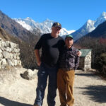
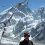
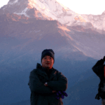
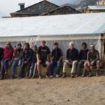
Gallery
FAQs
-
1. Where is Kang La Pass located?
Kang La Pass is situated in the remote Nar Phu Valley region of northern Nepal, within the Annapurna Conservation Area. It lies near the Tibetan border and connects the hidden Nar and Phu valleys with the Manang region. The pass stands at an elevation of around 5,300 meters (17,388 feet).
-
How long does the Kang La Pass Trek take?
The standard trek lasts about 17 days, starting from Kathmandu, traveling via Besisahar and Koto, and ending in Jomsom or Pokhara. The duration can vary depending on side trips, rest days, and acclimatization schedules.
-
How difficult is the Kang La Pass Trek?
This trek is challenging due to steep ascents, high-altitude crossings, and remote terrain. Trekkers should have good physical fitness, previous high-altitude trekking experience, and the ability to walk 6–8 hours a day.
-
What is the best time to do this trek?
The ideal seasons are spring (March to May) and autumn (September to November). These months offer clear skies, stable weather, and breathtaking Himalayan views. Winter crossings can be risky due to snow, and summer monsoon brings heavy rain.
-
Do I need a special permit for Kang La Pass Trek?
Yes. You’ll need: Annapurna Conservation Area Permit (ACAP) Nar Phu Restricted Area Permit Our team will arrange these for you before the trek.
-
Is altitude sickness a concern?
Yes. Since the trek goes above 5,000 meters, there is a risk of Acute Mountain Sickness (AMS). Our itinerary includes acclimatization days and gradual ascent. Drinking plenty of water, avoiding alcohol, and moving at a steady pace help reduce the risk.
-
What should I pack for the trek?
Essential items include warm layered clothing, trekking boots, a down jacket, gloves, hat, sleeping bag, personal medicines, water purification tablets, and headlamp. A full packing list will be provided once you book.Essential items include warm layered clothing, trekking boots, a down jacket, gloves, hat, sleeping bag, personal medicines, water purification tablets, and headlamp. A full packing list will be provided once you book.
-
How do we cross Kang La Pass?
The crossing is done early in the morning, usually after camping at a high camp. The path can be steep and snow-covered, requiring slow and steady progress. Your guide will ensure the safest route is taken.
-
Are guides and porters necessary?Are guides and porters necessary?
Yes. Due to the remote location, restricted area permits, and challenging terrain, hiring a licensed guide is mandatory. Porters are highly recommended to make the journey more comfortable.
-
What kind of views can I expect?
The trek offers incredible vistas of Annapurna II, Gangapurna, Tilicho Peak, Himlung Himal, and Pisang Peak, along with dramatic landscapes, deep gorges, and untouched Tibetan-influenced villages.
-
Is there mobile or internet connectivity?
In lower villages, some teahouses provide Wi-Fi and mobile networks. However, after entering Nar and Phu valleys and especially near the pass, connectivity is very limited or unavailable.
-
What kind of food is available during the trek?
Meals typically include Dal Bhat (rice and lentils), noodles, soups, bread, potatoes, and seasonal vegetables. In camping areas, our cook will prepare fresh meals for the group. Vegetarian options are widely available.
-
What is the cost of the trek and what’s included?
Prices vary depending on group size, duration, and services. Generally, the cost covers permits, transportation, accommodation, meals during the trek, guide, porter, and camping equipment. International flights, personal gear, insurance, and tips are not included.
-
Why choose The Himalayan Realms Treks for Kang La Pass?
We provide expert guides, customized itineraries, high safety standards, and personalized services. With decades of Himalayan trekking experience, we ensure your adventure is not only safe but unforgettable.